The British Isles
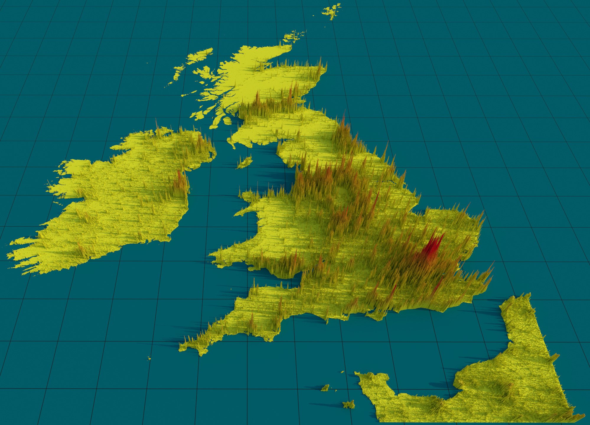
A rendering of The British Isles with voxel heights representing the population density (unitless), with population density data obtained from the Global Human Settlement Layer project (2015).
A rendering of The British Isles with voxel heights representing the population density (unitless), with population density data obtained from the Global Human Settlement Layer project (2015).
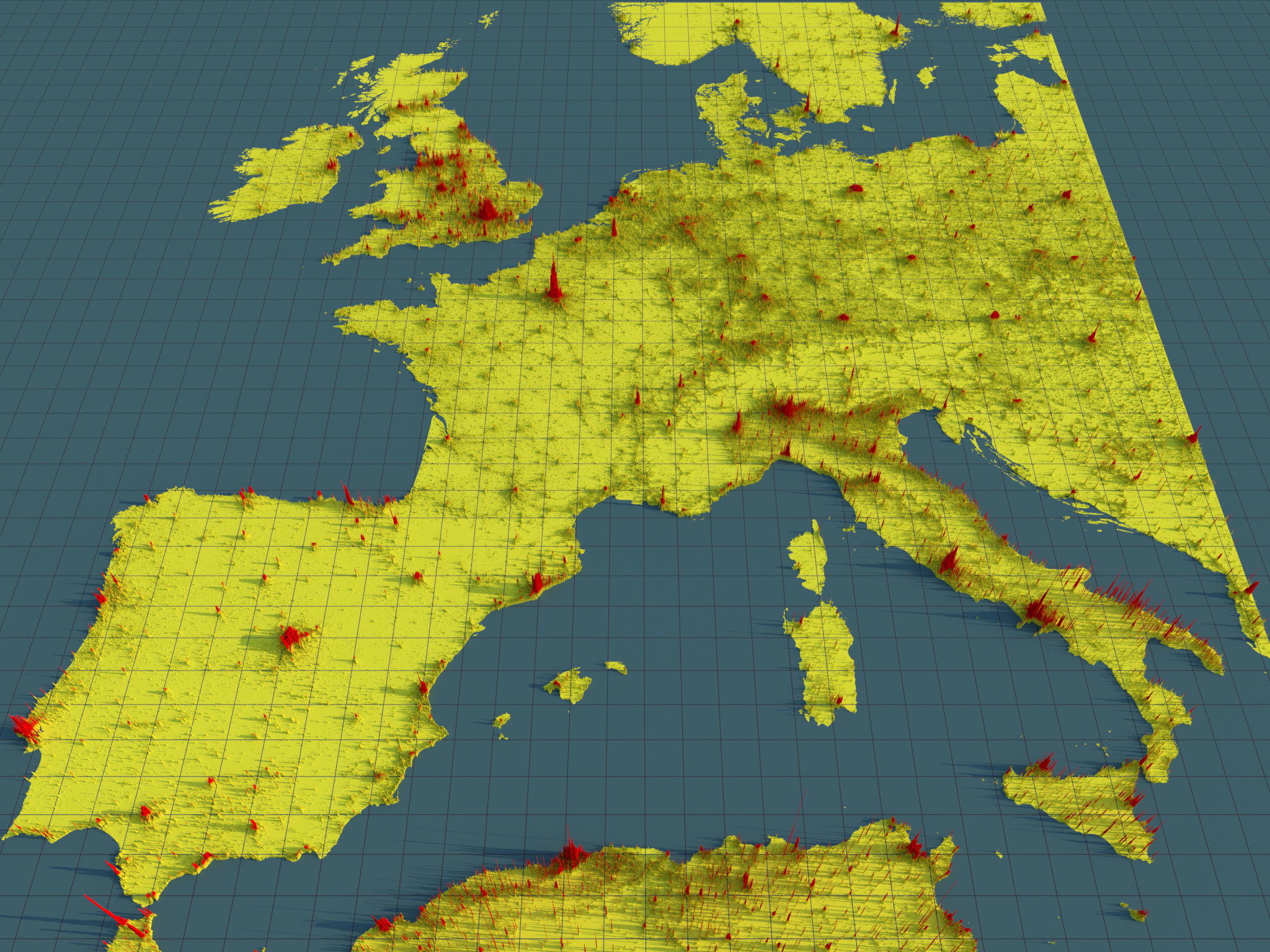
A rendering of Western Europe with voxel heights representing the population density (unitless), with population density data obtained from the Global Human Settlement Layer project (2015).

A rendering of Italy (with surrounding countries) with voxel heights representing the population density (unitless), with population density data obtained from the Global Human Settlement Layer project (2015).
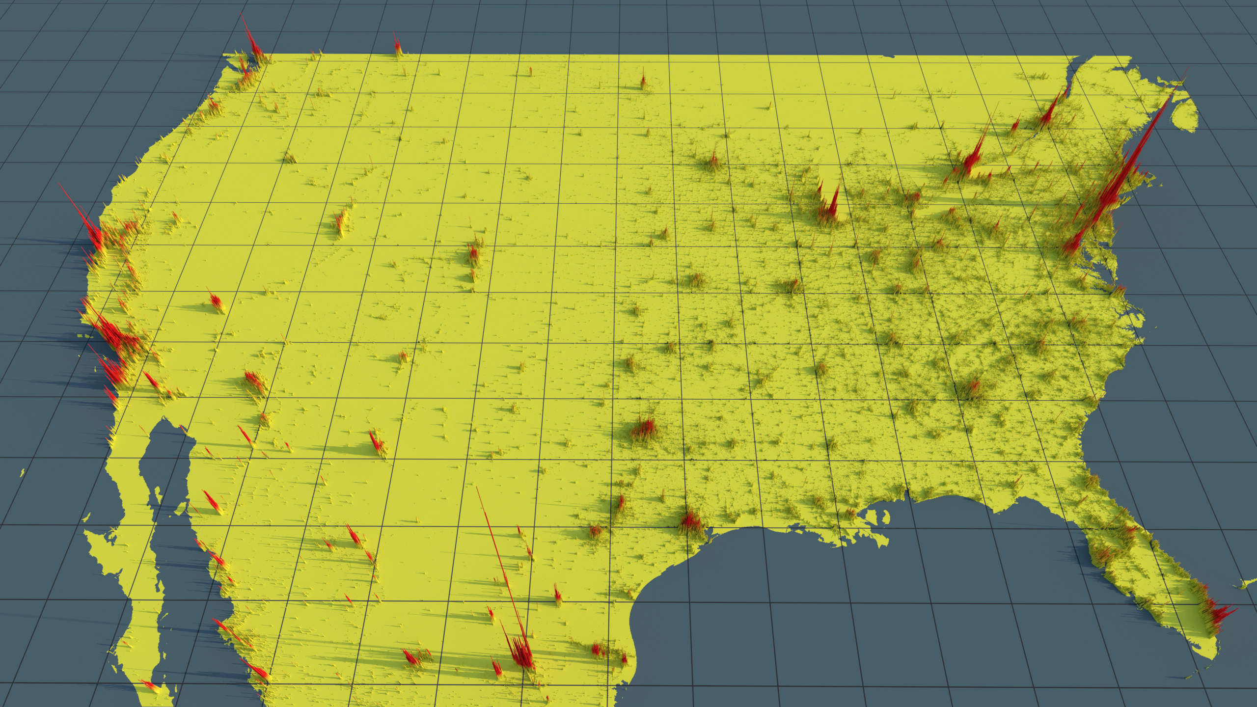
A rendering of the United States of America (with bits of Canada and Mexico) with voxel heights representing the population density (unitless), with population density data obtained from the Global Human Settlement Layer project (2015).
Terrain/sea data is slightly incorrect, as the original data has some artefacts adding non-existant land-masses in some areas.
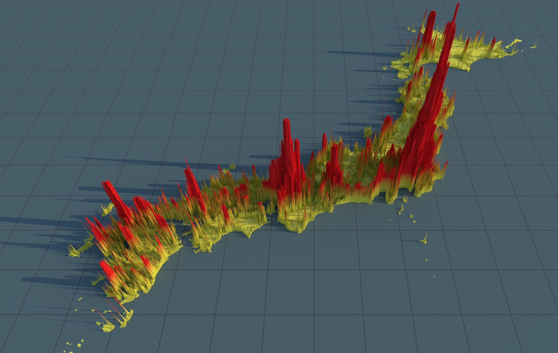
A rendering of Japan with voxel heights representing the population density (unitless), with population density data obtained from the Global Human Settlement Layer project (2015).
Terrain/sea data was fixed up (not completely), as the original data had artefacts adding non-existant land-masses.

A rendering of New Zealand with voxel heights representing the population density (unitless), with population density data obtained from the Global Human Settlement Layer project (2015).
Terrain/sea data was fixed up (not completely), as the original data had artefacts adding non-existant land-masses.

A rendering of Eastern Australia with voxel heights representing the population density (unitless), with population density data obtained from the Global Human Settlement Layer project (2015).

A rendering of the islands of the Caribbean with voxel heights representing the population density (unitless), with population density data obtained from the Global Human Settlement Layer project (2015).